Think of the ‘Great Road Trips of the World’ and Route 66 across the USA, the Great Ocean Road in Australia and the Southern Alps in New Zealand all spring to mind.
They may be surrounded by jaw-droppingly beautiful scenery but at the same time are pretty damn tame, with mile after mile of flat boring bitumen, tacky tourist shops and more cars than a Friday night rush hour in London.
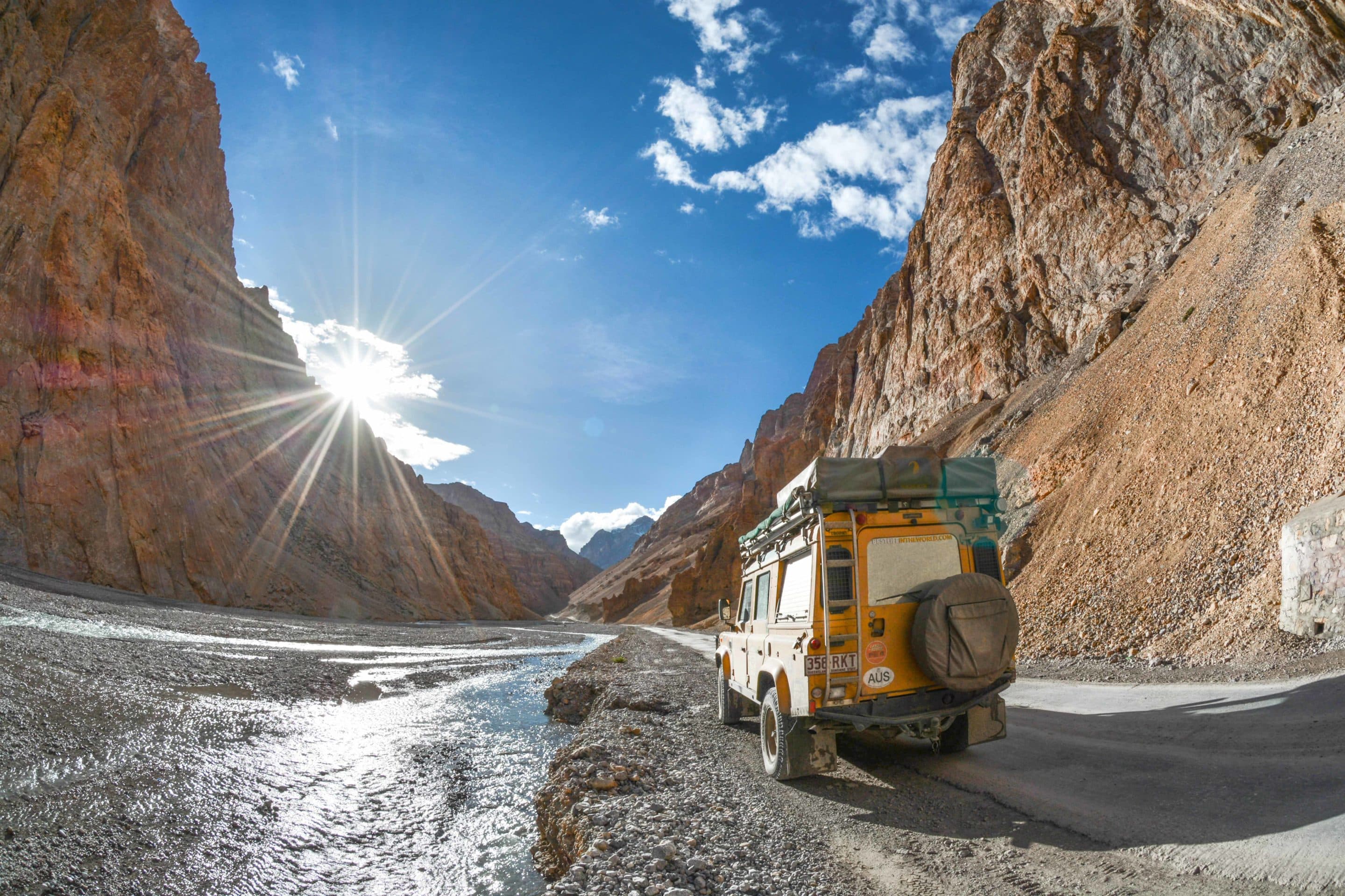 If you want to leave the madding crowds far behind and feel like taking on a REAL adventure across the roof of the world, then get yourself to northern India for what has to be the ultimate driving experience – the Leh to Manali Highway.
With an average elevation of over 4000m along the 480km route it’s not for the feint hearted. Add death defying drop-offs, mountain passes higher than Everest Base Camp (5150m) and the fact it’s only open for 4 months every year due to serious snowfall (last year a record 13 metres fell) – suddenly those other ‘greats’ are more like a Sunday afternoon run to the shops.
What it serves up in the scary stakes it more than eclipses with its total beauty and outright adventurous majesty. After four days traversing one of the highest roads on the planet, I’ve put together my Guide to the Best Drive in the World.
MANALI (elevation 2000m, KM 0) map
The starting point for most trips along the highway is Manali, a picture-perfect tourist destination at the southern end of this iconic road trip. Home to more marijuana than Cheech and Chong could smoke in a lifetime, the roaring Beas River, countless backpacker hangouts and enough Royal Enfield garages and hire shops to start a revolution, it’s a great place to wind up or wind down from the extraordinary experiences of the road.
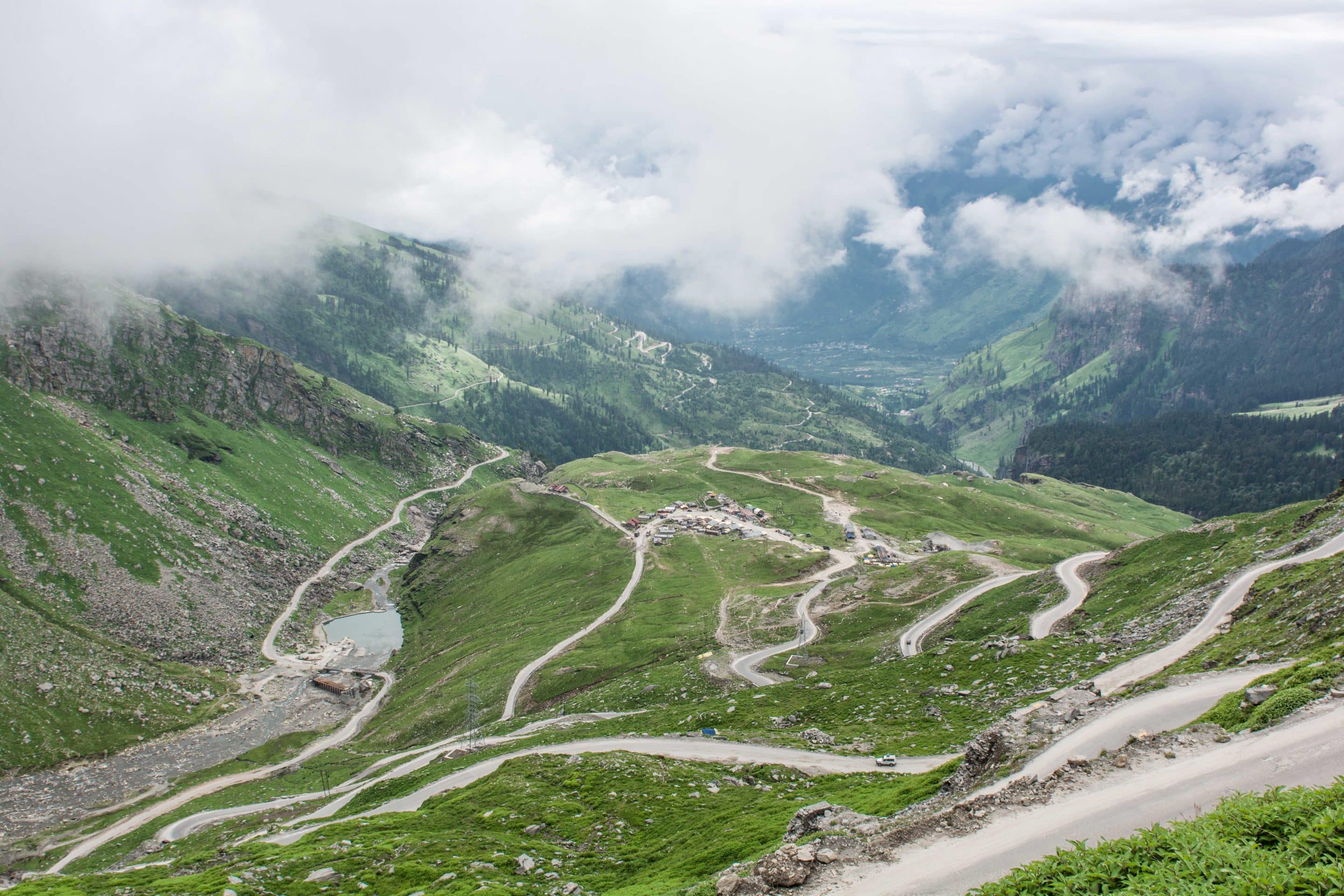
ROHTANG LA (elevation 3979m, KM 52) map
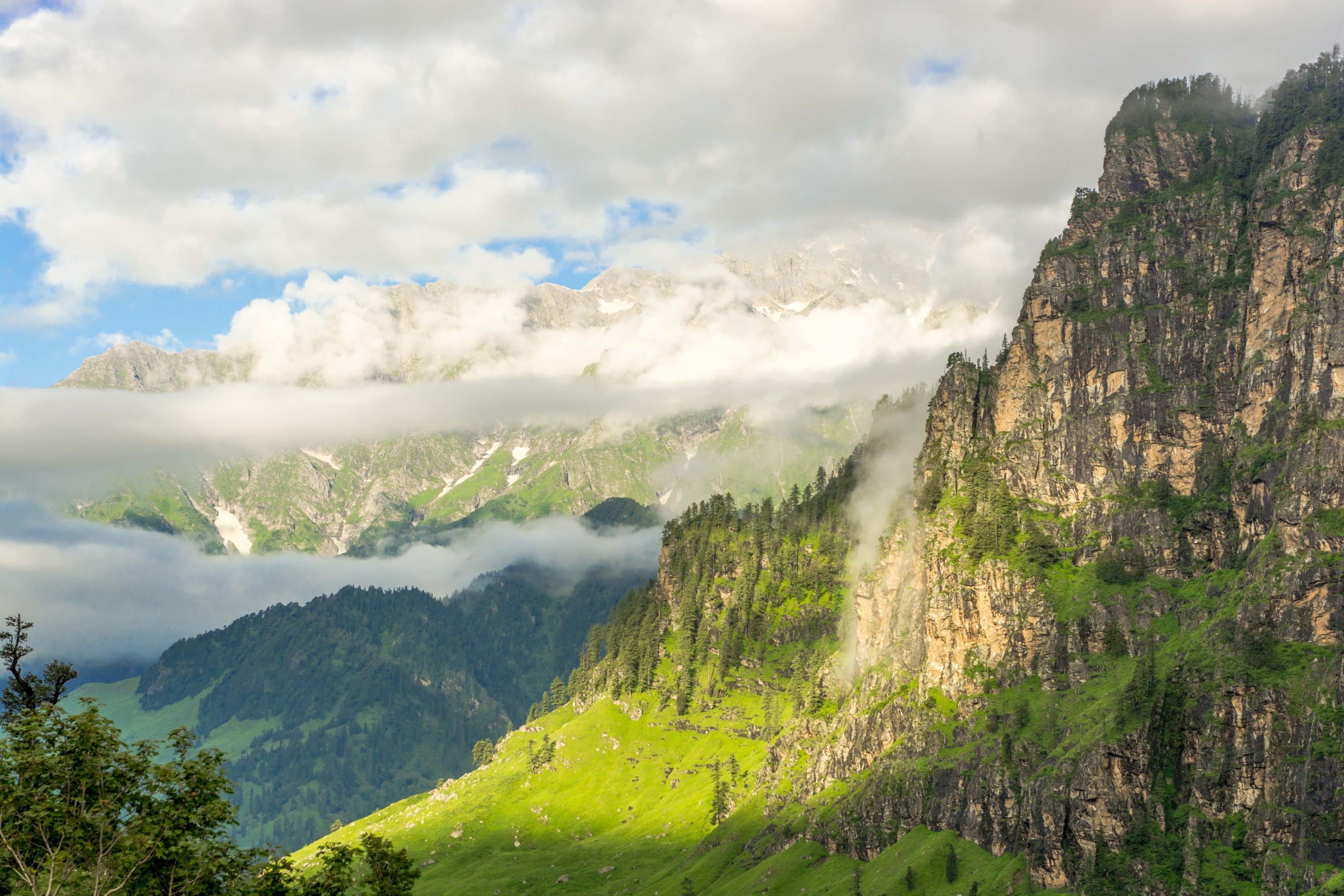
Leaving the beauty of the Beas Valley far behind, the road climbs steeply up and winds sharply around multiple switchbacks to the summit of the first pass on this road trip to the gods. Drive through verdant rich pastures, past jade green pine forests as gravity-defying waterfalls pummel the surrounding mountain rock faces.
It can be a busy part of the trip as most day-trippers from Manali make this highpoint their turnaround point. From here on in, only the truly adventurous dare to roam.
KEYLONG (elevation 3080m, KM 117) map
Say good-bye to consistent tarmac and hello to a lumpy, rocky, dusty surface from here on in. Clearing the Rohtang Pass delivers you into a land of high-altitude cold semi-arid desert where even the monsoonal rains that affect the rest of the India from July – September simply won’t fall.
Keylong is the perfect place for a lunch break if you started early in the day, to stay/camp overnight or stop for a few days to trek around the stunning Bhaga Valley. 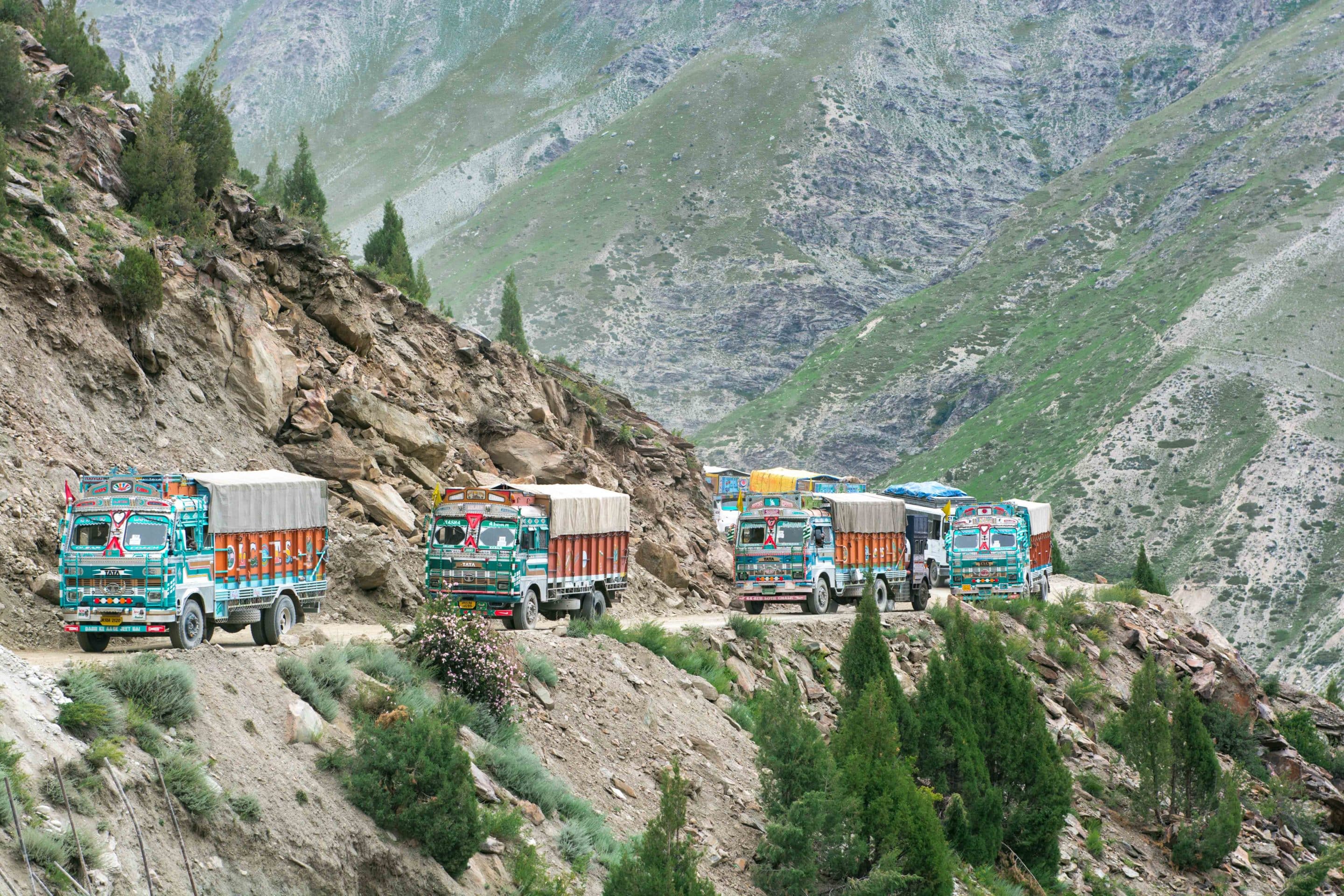
JISPA (elevation 3200m, KM 140) map
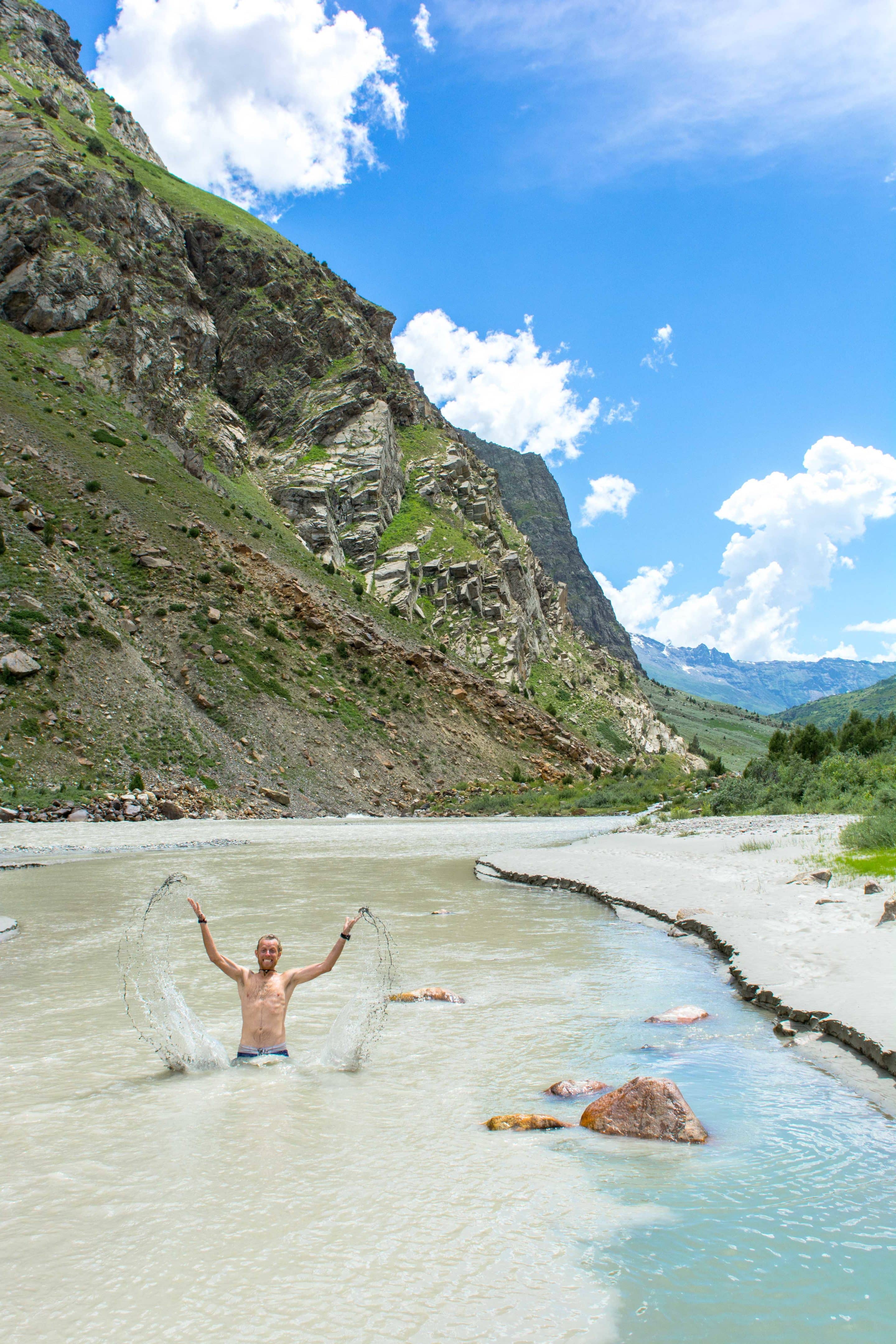
We arrived in Jispa after lunch having left Solang in the early hours of the morning, and stopped to take lots of photos along the way. Bar any major landslides or roadwork stops it’s a natural overnight camping spot with a number of sites right on the banks of the Bhaga River.
The incredible scenery, magnificent river valley and relatively low altitude mean it’s worth stopping here rather than pushing on through to Sarchu where the additional 1000 metres of elevation only 30 km up the road can bring on the symptoms of AMS as you’re not leaving enough time to acclimatise properly.
ZINGZING BAR (elevation 4270m, KM 171) map
Zingzing is one of the most dramatic and beautiful places on the route north to Leh. Home to an army camp, numerous roadside cafes and rest houses and even a bar for those lucky enough to be passenger on the trip.
By the time you reach here, the lush green hillsides have given way to brown desert grasses, where boulder-strewn mountain slopes rise to avalanche filled gullies and glacial mountain vistas.
SARCHU (elevation 4290m, KM 224) map
As we dropped into the Sarchu Valley I fought a constant battle in my head to stop saying wow! Driving along the precariously narrow, steep-sided track that calls itself a road, it’s easy to see how the unfortunate trucks that ended up in the valley below got there.
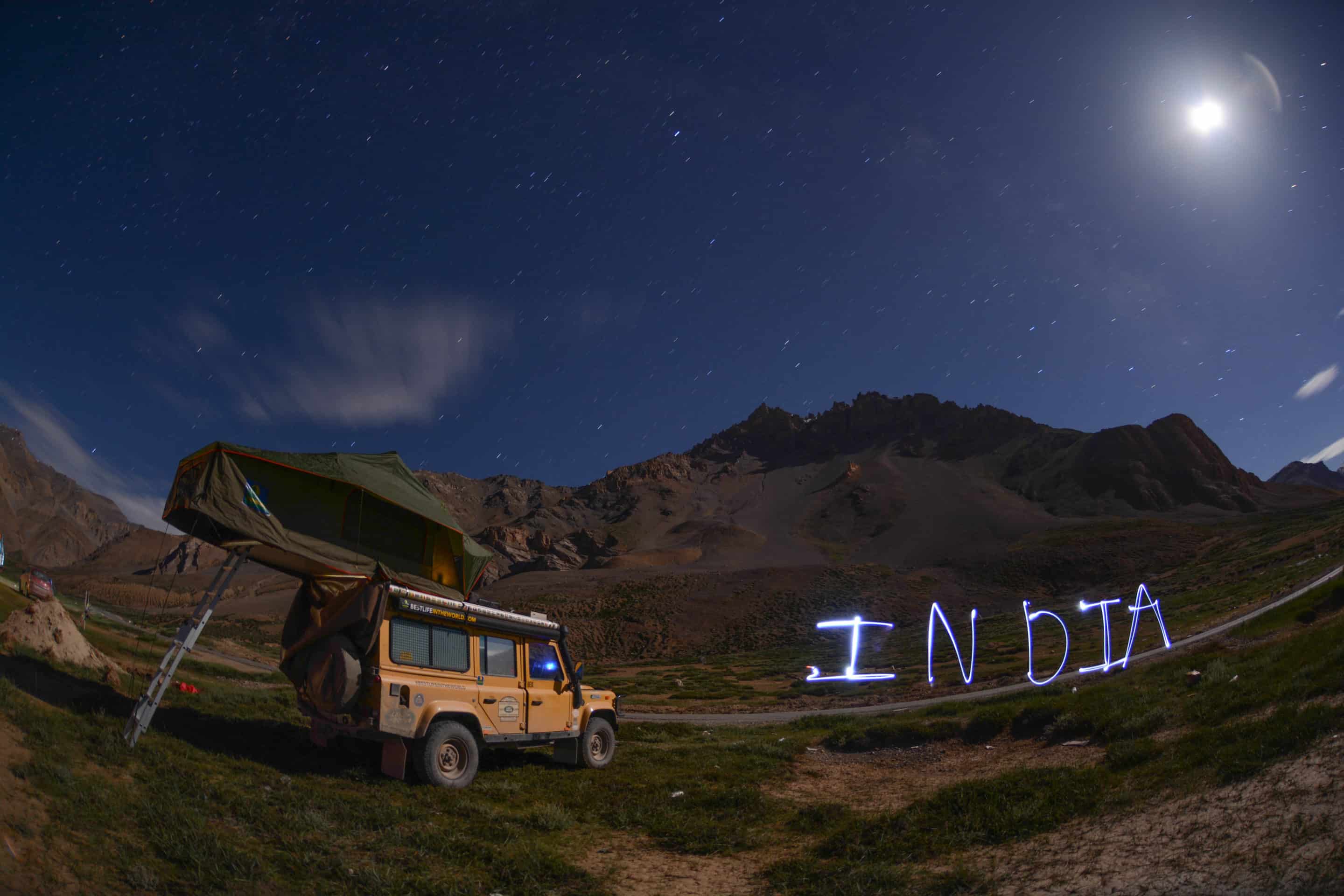
The vast green plains surrounded by the Himalayan ranges offer one of the most spectacular and picture-perfect camping locations you’ll find anywhere in the world.
Numerous campsites offer comfortable tents, communal social areas and tented toilets. At night the surrounding mountains provide the perfect location for some incredible starscape photos.
GATA LOOPS (elevation 4190 to 4739m, KM 256) map
When I think of a classic mountain drive I picture switchback turn after switchback turn and the Gata Loops offer 21 of them, one after another.
Climbing 500 metres from the valley floor this marvel of construction means you’re well over halfway to Leh by the time you reach the top of the twisting turns. It feels like you’re up with the gods with the pureness of air and intensity of the sun.
PANG (elevation 4739m, KM 301) map
When you arrive at Pang, it’s decision time – to stay the night and make Leh in three days, or push on and attempt it in two. The next 70kms keeping going up and up, and with limited accommodation options before Tanglang La (the highest point on the trip) it’s worth having a serious think about driving at night or stopping at altitude.
The army camp at Pang is the highest in the world. As you drive by and climb another series of switchback turns the view back across it makes you realise how isolated it is.
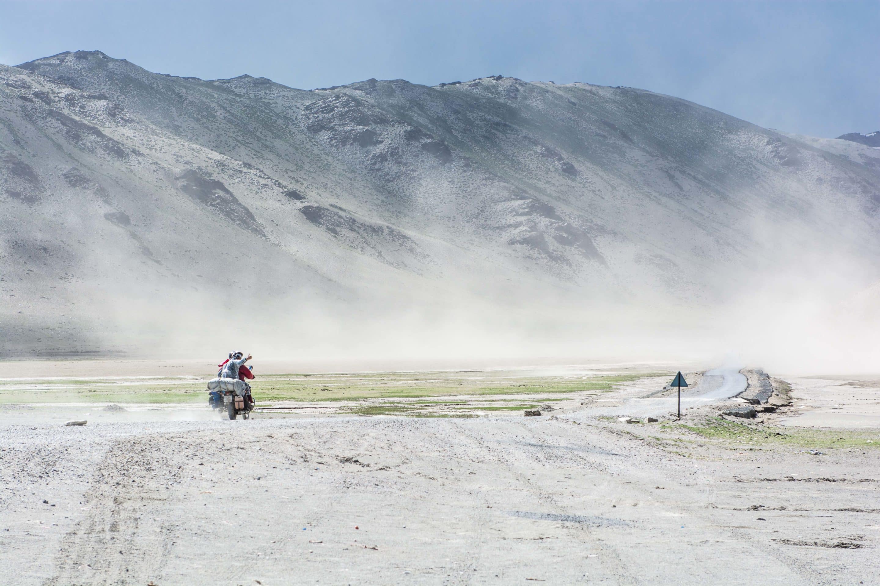
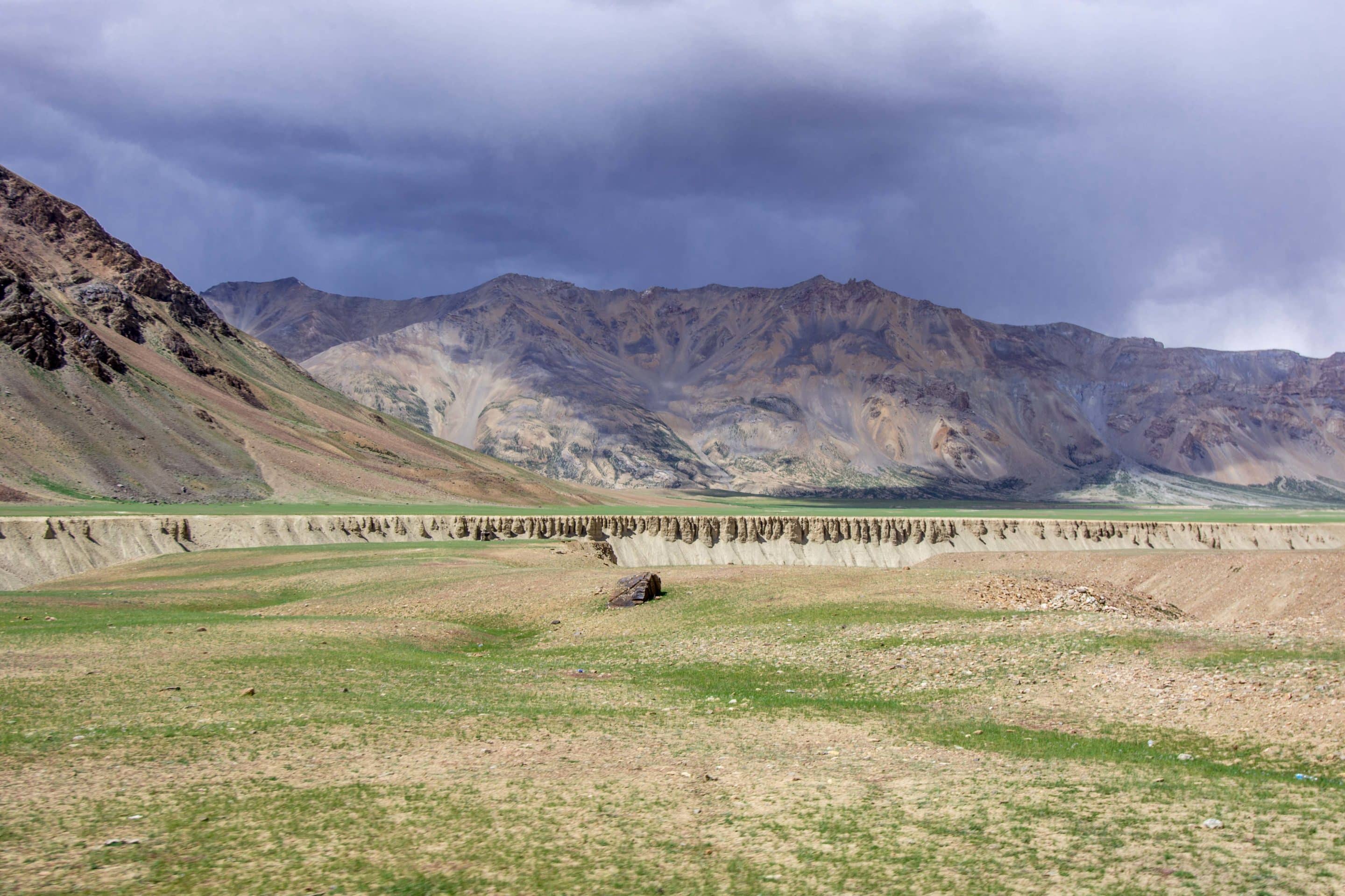
When you reach the top, the vast More Plains stretch out as far as the eye can see with a perfect tarmac road running for nearly 40km towards the highest part of the journey.
Photo opportunities abound with a deep river valley slicing an Indian Grand Canyon through the green landscape, hemmed in by the towering mountain range. The wind whistles across the plains fuelling regular dust storms and forcing fleeting storm clouds to race across the horizon. The place is out of this world!

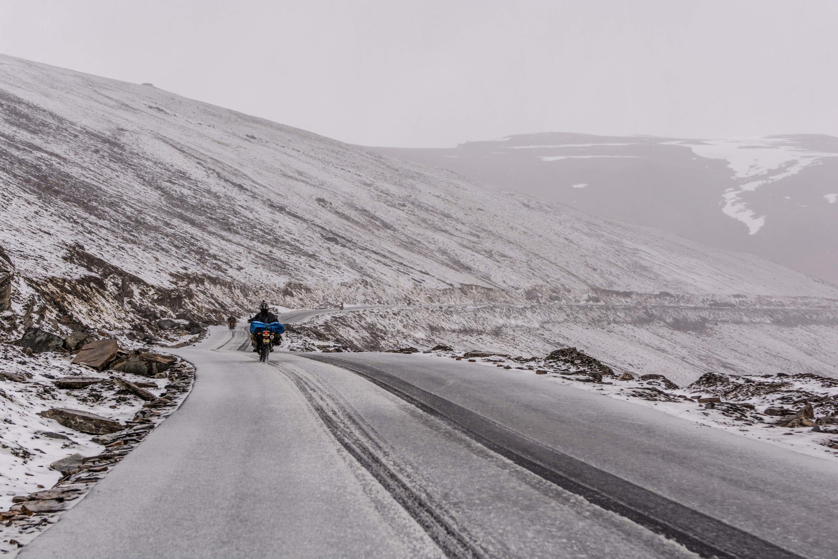
TANGLANG LA (elevation 5328m, KM 367) map
The pass at Tanglang La is the highest point of the entire journey and the jewel in the crown for anyone attempting the drive. It comes at the end of a continual 20km uphill slog across differing surfaces from broken tarmac to dusty plains to corrugations and through snow-melt rivers before reaching the summit point over 5 kilometres above the Indian Ocean.
At the top of the second highest motorable mountain pass on the planet, the views all around are nothing short of awesome and it’s worth taking the time to sit down and take it all in.
On our return journey the heavens opened with a torrential hailstorm turning the surrounding landscape bright white. It makes you feel pretty insignificant when you’re up that high!
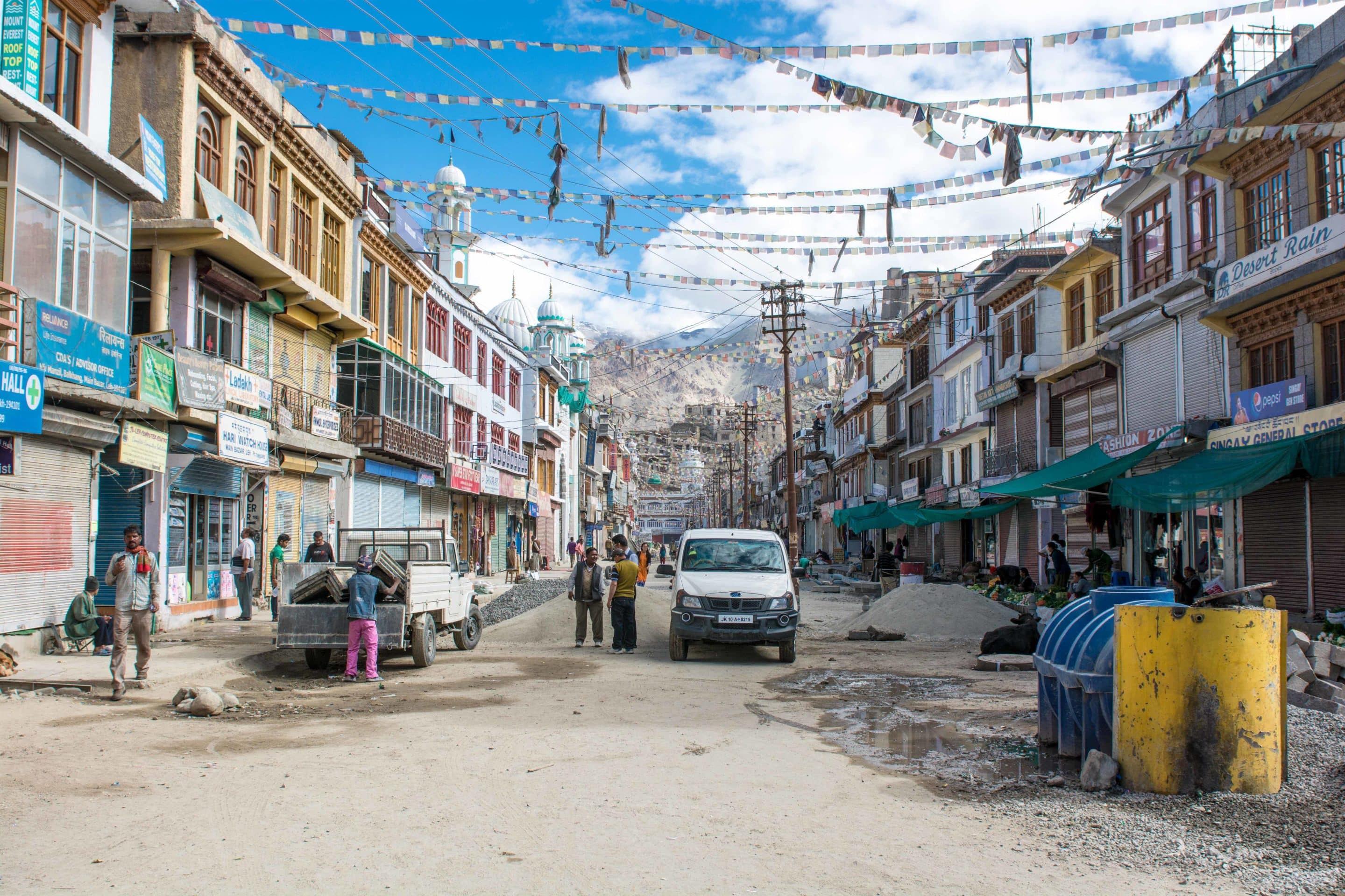
LEH (elevation 3500m, KM 478) map
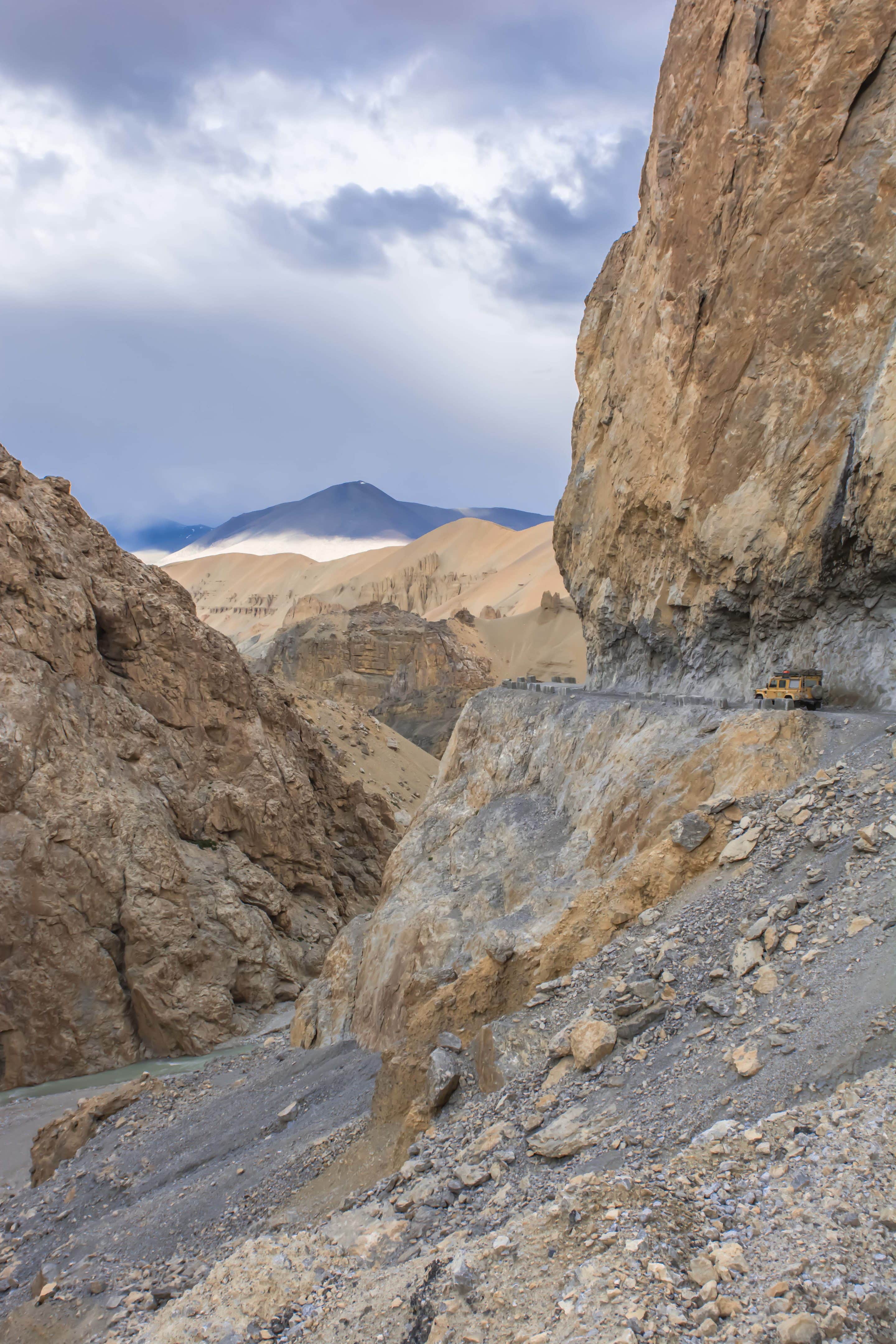
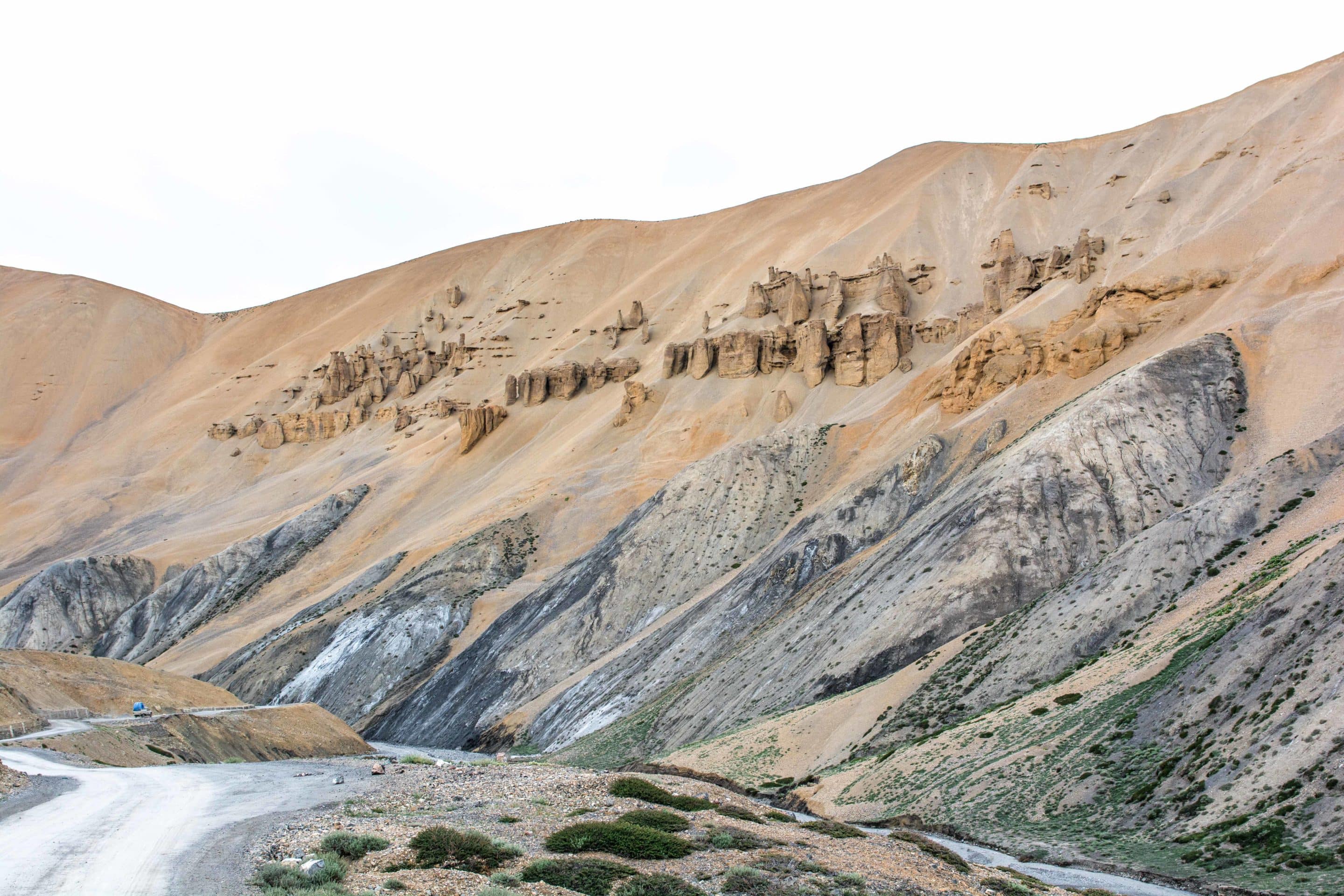
The final 100km into Leh take you through more unique landscapes on your high altitude adventure. Natural sand and rock formations along the Sumkel Lungpa River tower above the precariously highway that’s been hewn through protruding bedrock.
Angular precipices, circular arches and soaring scree slopes combine to form a lunar landscape that feels older than the earth. The rush of Himalayan melt water thunders through the valley floor, washing out river banks on which the road perilously runs.
Reaching the village of Upshi means you’re almost made it. It’s a relaxing drive from here where you can take in the vistas that have made this part of the world so famous – welcome to the Moon!
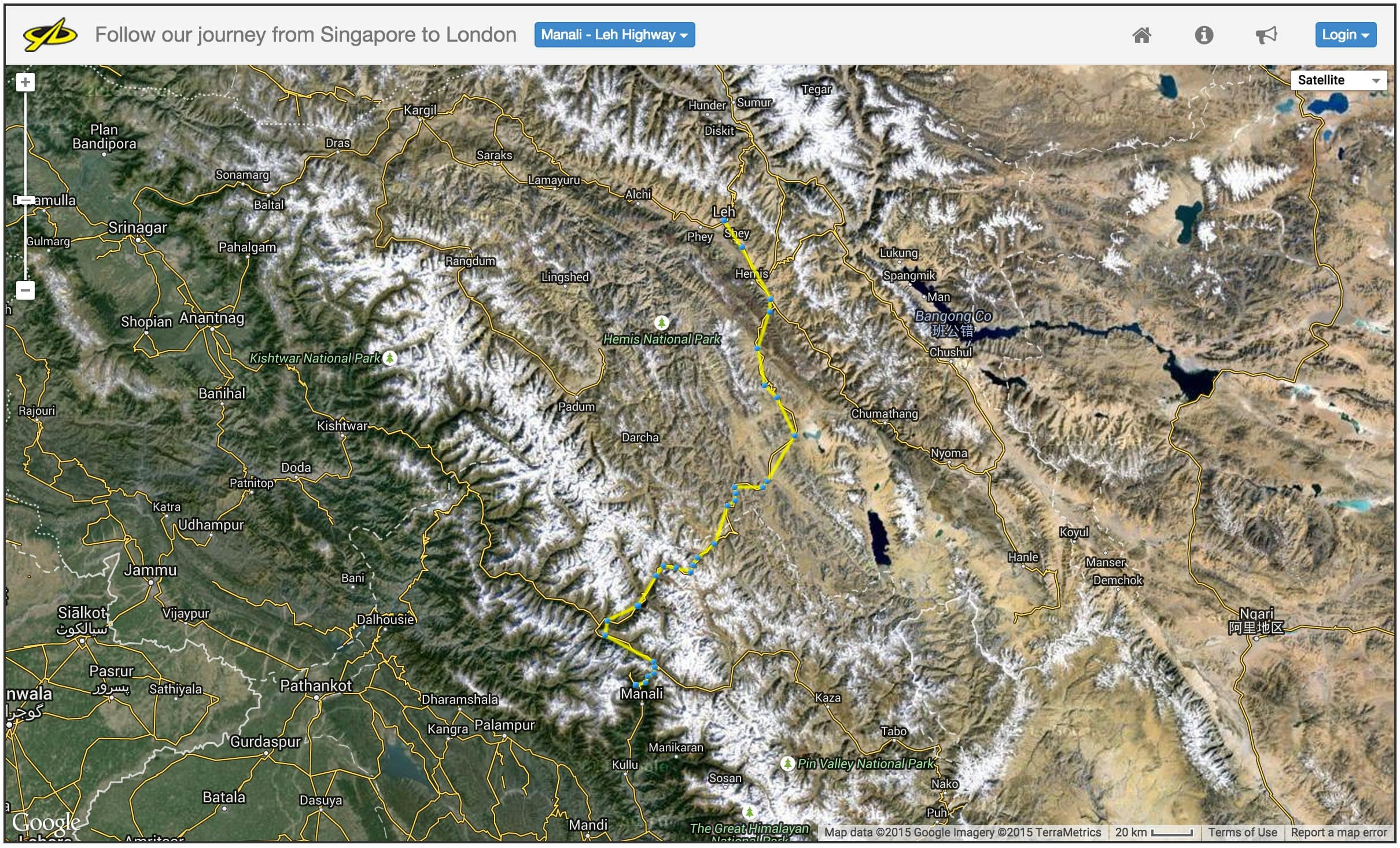
OUR ROUTE – to see our route visit this page and select ‘Manali – Leh Highway’ from the blue pull down menu.
FAST FACTS
- PERMITS – to help protect the environment a limited number of travel permits are issued every day
- You need one if you’re travelling from Manali north up the Rohtang Pass. Coming from Leh you’re free to travel whenever you like
- They are available from the Manali DC Office between 10am and 1pm every day
- Foreigners are required to take photocopies of their driving licence, vehicle registration document, have a PUC test certificate (pollution check done on your vehicle available at most petrol stations) and proof that your vehicle is under 10 years old
- OPENING DATES – between May, when the snow is cleared and early October, when snowfall blocks the high passes once again. It’s worth checking this page for the latest status
- TOTAL LENGTH – 484km if you do the entire stretch from Manali to Leh (and you have to!)
- DAYS TO COMPLETE – between 2 and 4 depending on how many hold-ups, diversions and speed of your vehicle. Don’t rush it – it’s simply stunning
- THE PERFECT RIDE – Traditionally you either ride a Royal Enfield (available for hire in Manali or Leh) or take a 4WD
- FUEL STOPS – Fill all your tanks/bottles/cans in Manali, there’s a petrol/diesel station 110kms on in Tandi and the next one is 345km further on, only 30km before Leh.
- FOOD – carry enough in case you get stuck for a few hours or overnight in case of a breakdown. Cafes along the way sell chai tea, snacks and cook full meals too
- ATMs – take enough cash to see you through the entire journey, just in case
- BEDS – camping options are plentiful along the way at the major stops mentioned above. If you don’t make it to a major stopping point the road side cafes have facilities for sleeping – you’ll just be alongside the owner, his wife, kids and dogs
TOP TIPS
- ACCLIMATISE PROPERLY – the mind-twisting headaches and sickness associated with travelling to the top of the high passes too quickly can be horribly debilitating. Try and stay above Manali if at all possible the night before leaving. The village of Solang has a few hotels and camping areas and sits at an altitude of 2500m. It’s not perfect but it’s better than Manali at 2000m
- DON’T STOP AT SARCHU – after a day’s driving it looks like the perfect place to stay when you arrive in the wide valley complete with picture perfect campsites, but leave Sarchu until the drive back. Staying at over 4200m is bound to give you a terrible night’s sleep…it’s not called the Vomit Hilton for nothing!
- HYDRATE AND DON’T WAIT – drinking at least 2 litres of water every day is one way to combat the effects of AMS. Detours and hold-ups are all part of the exciting journey, but be prepared. If you have to stop on one of the high passes (usually at over 4500m) the effects of altitude sickness will kick in pretty quickly
- START EARLY – on Day One especially. It pays to get a good distance under your wheels. You never know what’s going to happen enroute and having a few extra hours of daylight at the end of the day means you can kick back and enjoy your surroundings
- ROAD WORK DAY – Tuesday is as designated ‘Road Work Day’ meaning the road is closed at 6am for all Leh-bound traffic (from the first permit checkpoint around 6km from Solang village) for the entire day. What is does mean, is if you’re coming in the opposite direction there’s almost no traffic for the final stretch from Sarchu to Manali. Time your trip well and it works in your favour!
Have you driven the Manali Leh Highway before? What are you favourite, most exciting drives in the world? Share your story with us and we’ll try to get there ourselves!